Charting Earth’s Surface
> Part 1 of 4
True North
vs Magnetic North
Understanding the two norths that guide your navigation
Mission: Grand Canyon Erosion
Aerial Documentation
Field Notes 1: Pre-Flight Navigation
You’re preparing for a documentation flight at Grand Canyon National Park as part of Aerial Atlas Coalition. A new pilot is joining you for the first time, and you’re walking them through the pre-flight briefing.
You pull out your sectional chart and point to three waypoints marking a stretch of riverbed — a documented habitat area. These waypoints are located within a strict corridor, since the National Park doesn’t want drones anywhere near helicopter airspace.
The new pilot, glancing down at their drone controller says, “I’ll fly Southeast toward the river, based on the drone’s compass.”
You chime in, “Actually, we’re not flying this by compass direction. I’ve programmed it as a waypoint mission — three exact spots straight off this Sectional Chart, each one along the riverbed. The drone flies to each coordinate point, one after another, automatically.”
The new pilot looks up, confused. “Why not just fly that way using the compass? Wouldn’t that get us there?”
“Flying by compass only tells the drone which way to point, but it doesn’t know exact, precise spots. That’s fine for a lot of flights. But we need to capture three precise locations along this river, not just ‘somewhere in that direction.'”
“So how’d you get the exact spots programmed into the drone?” asked the new pilot.
“Straight off the Sectional Chart. The chart’s coordinates are already based on true north. I just typed the chart’s numbers straight into the controller.”
There are two totally different ways to point a drone somewhere:
Method 1 — “fly this direction.” You look at your compass, pick a direction (say, northwest), and fly that way. This only tells the drone which way to point. It doesn’t know exact spots — it’s just “go that way and see what you find.” Your drone’s compass, when it does this, is reading off what is called Magnetic North.
Method 2 — “fly to this exact spot.” You type in real coordinates (like you’d find on a chart or Google Maps), and the drone flies straight to that specific point, no matter which way it currently happens to be facing. This uses GPS positioning, which is based on True North / actual geographic location — not the compass at all.
In this Lesson You’ll Learn:
- Why your drone’s compass and your sectional chart don’t point to the same north
- How to identify True North vs. Magnetic North on maps and instruments
- Why understanding both norths prevents you from flying off course
True North vs Magnetic North
True North
stable and unchanging
True North is the direction pointing toward the fixed geographic North Pole. True North is the actual, physical top of the Earth where the planet’s axis of rotation meets the surface.
It’s stable and unchanging. No matter where you are on the planet, True North always points to the same spot: the North Pole.
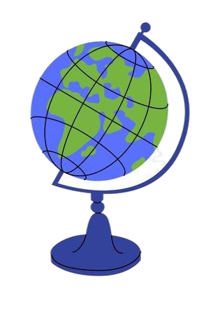
Think of it this way: Imagine a plastic globe sitting on your desk. The axis it spins on (the rod running through the center from top to bottom) points to the North Pole at the top. That point never moves. The North Pole will always be the North Pole. That’s True North.
Key Characteristics of True North:
- Points directly to the geographic North Pole
- Aligns with Earth’s axis of rotation
- Serves as a fixed, reliable navigational reference
- Never changes—it’s the same everywhere on Earth
- Used on sectional charts, topographic maps, and satellite overlays
On maps, True North is represented by lines of longitude (also called meridians), which all converge at the North Pole. These vertical grid lines run from the South Pole to the North Pole, creating the map’s north-south reference system.
Why it matters for pilots: When you’re planning flight paths, programming specific coordinate waypoints into your drone, reading sectional charts, or orienting yourself with airspace boundaries, you’re working with True North. It’s your map-based reference for navigation.
Magnetic North
Used by compass needle
Magnetic North is the direction your compass needle points, which is based on Earth’s magnetic field, not the geographic North Pole.
Unlike True North, Magnetic North is not fixed.
Earth’s magnetic field is generated by molten iron flowing in the planet’s outer core, and that field shifts over time.
Right now, Magnetic North is located in the Canadian Arctic, hundreds of miles away from the geographic North Pole, and it’s slowly drifting northwest toward Siberia.
Key Characteristics of Magnetic North:
- The direction a compass needle points
- Generated by Earth’s magnetic field (not geography)
- Changes location over time as the magnetic field shifts
- Currently located in the Canadian Arctic (not at the North Pole)
- Used by compasses, drone navigation systems, and aviation instruments
Your drone’s internal compass navigates using Magnetic North. When you see a heading on your controller or flight app, it’s referencing the direction your compass points, which is Magnetic North.
Why it matters for pilots: Your drone flies based on Magnetic North, but your sectional chart is oriented to True North. If you don’t account for the difference between them, you could fly off course.
Quick Comparison
True North
What it is: The geographic North Pole
How it’s determined: Earth’s axis of rotation
Does it move? No—it’s fixed
Used by: Maps, charts, satellite imagery
Your role: Planning and reading charts
Magnetic North
What it is: Where your compass points
How it’s determined: Earth’s magnetic field
Does it move? Yes—it drifts over time
Used by: Compasses, drones, aircraft instruments
Your role: Flying and real-time navigation
Where Are They Located?

This image shows the critical difference between True North and Magnetic North on a map of the Arctic.
True North is marked at the geographic North Pole—the fixed point where Earth’s axis of rotation meets the surface. It never moves.
Magnetic North is currently located in the Canadian Arctic, hundreds of miles away from the geographic pole. This is where a compass needle actually points, following Earth’s magnetic field rather than geography.
The distance between them varies depending on where you are on Earth. For pilots, this difference—called magnetic declination or magnetic variation—must be accounted for when converting between chart-based navigation (True North) and compass-based navigation (Magnetic North).
Where Are They Located?

Above: Historical path of Magnetic North from 1632 to 2020
Unlike True North, which stays fixed at the geographic North Pole, Magnetic North is constantly drifting.
This image tracks the movement of the Magnetic North Pole over nearly 400 years. Notice how its position has shifted dramatically, especially in recent decades.
Why does it move?
Earth’s magnetic field is generated by molten iron flowing in the planet’s outer core. As that flow changes, the magnetic field shifts—and so does Magnetic North.
How fast is it moving?
Over the past two decades, Magnetic North has been drifting at an average rate of about 10 kilometers (6.2 miles) per year, moving northwest from the Canadian Arctic toward Siberia.
Why it matters for pilots: Because Magnetic North moves, the difference between True North and Magnetic North (magnetic declination) changes over time and varies by location. Sectional charts list the current magnetic declination for each area, but these values are updated periodically as the magnetic pole continues its journey. This is why pilots use True North for map-based planning—it’s reliable and unchanging—while accounting for magnetic declination when flying with compass-based instruments.
Lesson Practice Exam
Take your time.
What’s Next?
In the following lessons, you’ll learn to interpret wind codes, visibility notation, weather phenomena abbreviations, and cloud coverage—step by step, on both METAR and TAF Reports.
By the end of this module, you’ll be able to look at any METAR or TAF report and know exactly what conditions to expect.